Land4 for Archicad
0
17
Land4 for Archicad v23 v24 v25 WiN x64
LAND4 v.04.04 for ArchiCAD 27 Win x64
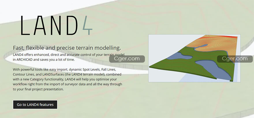
快速、灵活和精确的Archicad地形建模插件。
LAND4在ARCHICAD中提供对地形模型的增强、直接和精确控制,并为您节省大量时间。
借助诸如“轻松导入”、“动态高程点”、“坠落线”、“等高线”和“陆地表面”(LAND4地形模型)等功能强大的工具,以及新的类别功能,LAND4将帮助您从勘测员数据的导入到最终项目演示,优化您的工作流程。
Fast, flexible and precise terrain modelling.
LAND4 offers enhanced, direct and accurate control of your terrain model in ARCHICAD and saves you a lot of time.
With powerful tools like easy import, dynamic Spot Levels, Fall Lines, Contour Lines, and LANDSurfaces (the LAND4 terrain model), combined with a new Category functionality, LAND4 will help you optimise your workflow right from the import of surveyor data and all the way through to your final project presentation.

描述:
标签: Archicad 建模 软件 插件 工具 地形
分类:资源 > 软件资源 > 软件资源:未分类
发布:CGer | 查看: | 发表时间:2022/6/28 11:38:28 | 更新时间:2025/4/5 11:19:29
标签: Archicad 建模 软件 插件 工具 地形
分类:资源 > 软件资源 > 软件资源:未分类
发布:CGer | 查看: | 发表时间:2022/6/28 11:38:28 | 更新时间:2025/4/5 11:19:29
| 常见问题,点击查询: | ||
| ●CGer(Cg儿)资源下载帮助 | ||
| ●资源名词解释 | ||
| ●注册/登陆问题 | ||
| ●充值出错/修改密码/忘记密码 | ||
| ●充值赠送系统 | ||
| ●文件解压出错/解压密码 | ||
| ●Payment with Paypal | ||
| ●哪些资源会被列为付费资源 | ||
| ●为何要充值解锁 | ||
| ●免责条款 | ||
| ●联系站长(联系站长前请先仔细阅读 免责条款 ,网站只提供资源,不提供软件安装等服务!) | ||
全部评论 (0)


