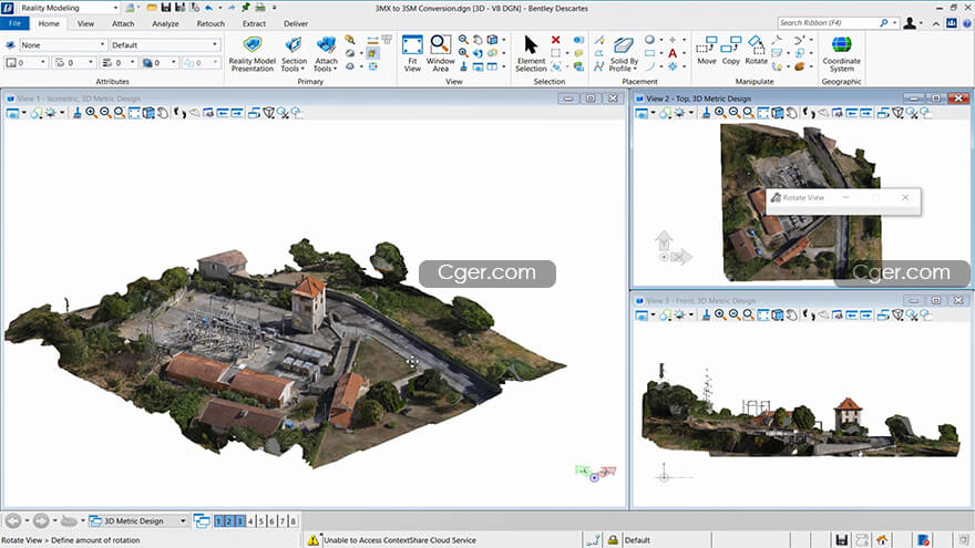
Bentley Descartes CONNECT Edition Update 16 10.16.00.15x64
3D图像的高级处理软件,充分利用真实建模数据,将点云、真实网格、可缩放地形模型和光栅图像集成到基础架构工作流中。
使用Descartes,您可以通过以下功能扩展您的能力,从任何比例的真实建模数据中提取价值:
可视化并操纵其显示
将其与CAD、BIM和GIS数据相结合
提取地形模型等信息
编辑和清理现实建模数据
当基础设施项目需要转换遗留文档时,Descartes帮助您将所有图像集成到工程工作流中。

Advanced Processing for 3D Imagery
Make the most of your reality modeling data with the ability to integrate point clouds, reality meshes, scalable terrain models, and raster imagery into your infrastructure workflows.
With Descartes you can extend your capabilities to extract value from reality modeling data of any scale through the ability to:
Visualize and manipulate its display
Combine it with CAD, BIM, and GIS data
Extract information like terrain models
Edit and clean up reality modeling data
When infrastructure projects require the conversion of legacy documents, Descartes helps you integrate all imagery in your engineering workflows.
You benefit from the ability to:
Work with all data types, regardless of size, in a single product
Use advanced modeling, clipping, and sectioning tools to create 3D models of as-built conditions
Extract ground and breaklines from reality meshes and point clouds
Search and visualize reality meshes by enriching and classifying regions with additional information
Streamline point cloud to geometry conversion
Enrich, segment, and classify point clouds and combine them with engineering models
Produce animations and renderings for presentations
In addition to its robust capabilities to work with reality modeling data, the software ensures you have seamless integration with ProjectWise ContextShare. This integration provides streaming that helps you work with extremely large files.
分类:资源 > 软件资源 > 软件资源:未分类
发布:CGer | 查看: | 发表时间:2022/3/4 14:35:41 | 更新时间:2022/3/4 14:35:41
| 常见问题,点击查询: | ||
| ●CGer(Cg儿)资源下载帮助 | ||
| ●资源名词解释 | ||
| ●注册/登陆问题 | ||
| ●充值出错/修改密码/忘记密码 | ||
| ●充值赠送系统 | ||
| ●文件解压出错/解压密码 | ||
| ●Payment with Paypal | ||
| ●哪些资源会被列为付费资源 | ||
| ●为何要充值解锁 | ||
| ●免责条款 | ||
| ●联系站长(联系站长前请先仔细阅读 免责条款 ,网站只提供资源,不提供软件安装等服务!) | ||


